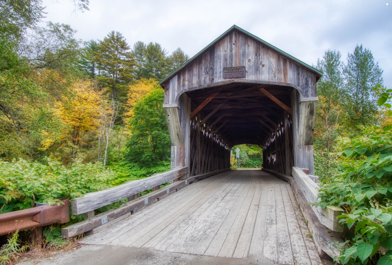
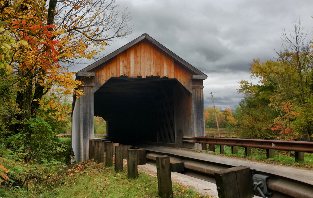
Bartonsville Bridge
Lower Bartonsville Road
Bartonsville in Rockingham, VT, 05143Phone:
Location: Off Route 103 on Lower Bartonsville Road at the south edge of Bartonsville.
The Bartonsville Bridge, built in 1870 by the Sanford
Granger, is an impressive 158-foot-long town lattice. This bridge is one of the
longest in Vermont. It carries Pleasant Valley Road over the Williams River.
Parking on west side of the road.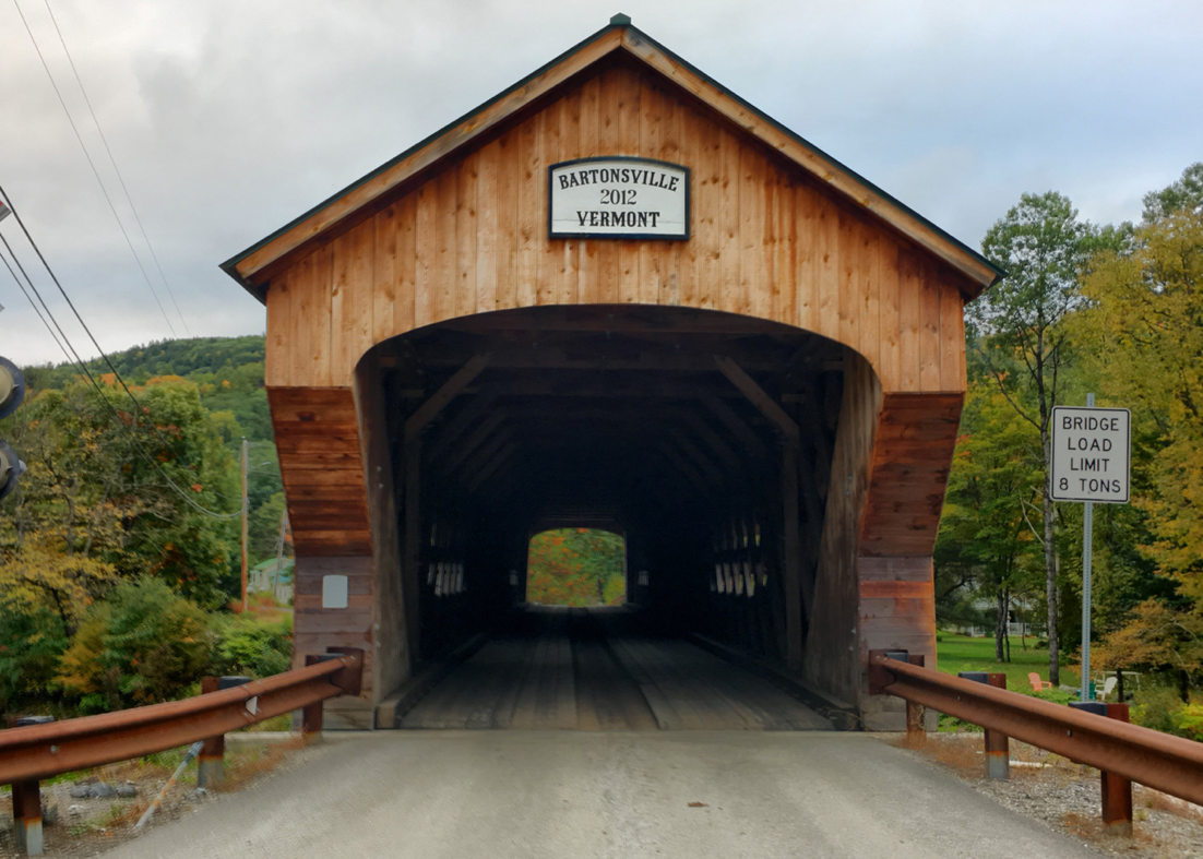
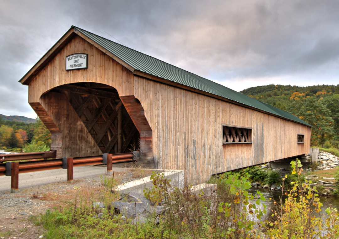
Oct 7, 2018
Cooley Bridge
Elm Street
Pittsford, VT, 05763Phone:
Location: Old Pittsford, Proctor Road. Travel 1.1 miles northwest of the junction of Route 3 on US7 then left at the second turn on Elm Street; then 1.2 miles to the bridge.
The Cooley Bridge, built in 1849 by Nicholas Powers, carries
Elm Street over the Furnace Brook. Town lattice truss; 53 feet long. Parking in
pull off near bridge.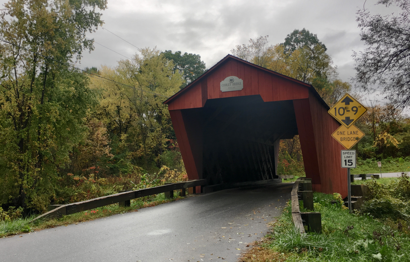
Oct 11, 2018
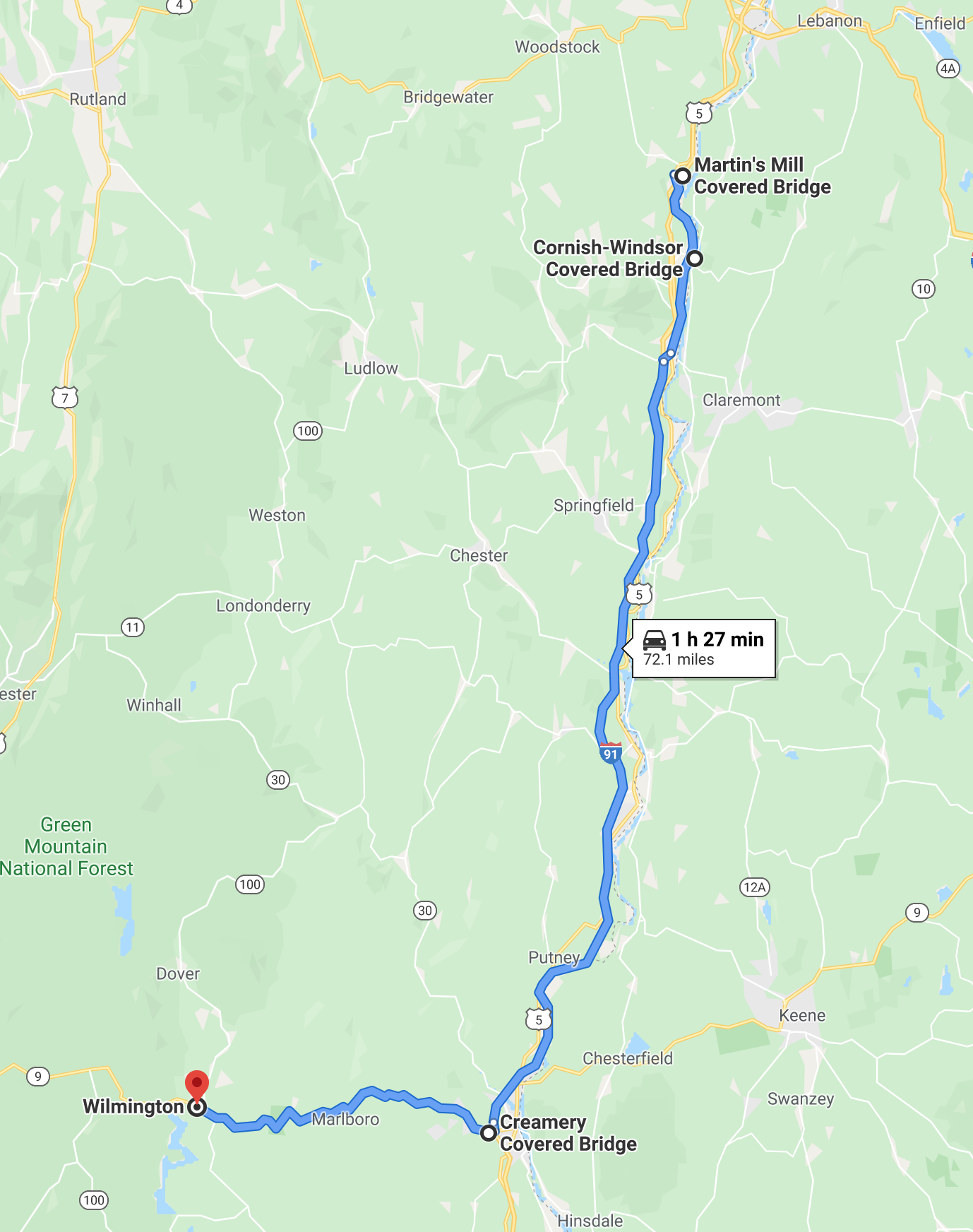
Cornish-Windsor Bridge (or Windsor-Cornish)
Crosses the Connecticut River between Bridge Street,
Windsor, VT, and NH Route 12A, Cornish, NH
Windsor, VT, 05089Phone:
Location: 0.3 miles south of the junction of Route 44 at Windsor on US5 then 0.2 miles left.
Probably the most prominent of all of Vermont’s and New
Hampshire’s covered bridges, the Cornish-Windsor Bridge, built in 1866, is the longest
wooden covered bridge in the United States and the longest two-span covered
bridge in the world. At 450 feet long, the bridge consists of two spans
supported by Town lattice trusses. The pier stands nearly under the midpoint of
the bridge: the two clear spans measure 204.6 feet and 203.7 feet. The bridge
is listed on the National Register of Historic Places. Three earlier bridges at
this spot, the first of them built in 1796, were destroyed by floods. The
bridge, which originally cost $9,000 to build, was rebuilt in 1989 at a cost of
$4,450,000 and reopened on December 8, 1989. Vermont and New Hampshire share
the Cornish-Windsor Bridge.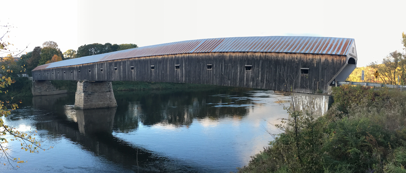
Oct 12, 2018
Creamery Covered Bridge
Windham County
West Brattleboro VT near Vermont Country Deli
The Creamery Covered Bridge is a historic covered bridge in West Brattleboro, Vermont. Now closed to traffic, the Town lattice truss bridge formerly carried Guilford Road across Whetstone Brook, just south of Vermont Route 9. Built in 1879, it is Brattleboro's last surviving 19th-century covered bridge. The Creamery Covered Bridge is about 1.5 miles (2.4 km) west of downtown Brattleboro, just south of Vermont Route 9 and west (upstream) of the current alignment of Guilford Road, which it previously carried.
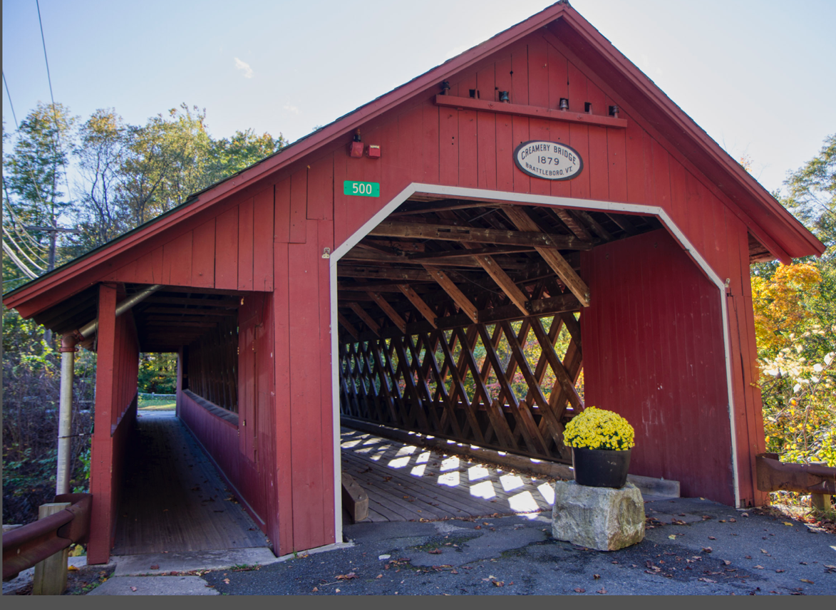
Oct 12, 2018
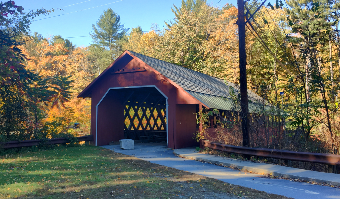
Gorham / Goodnough Bridge
Gorham Bridge Road
Pittsford/Florence, VT, 05763Phone:
Location: About 2 miles south of the junction of US7 at Pittsford Mills on Route 3 then right on Gorham Bridge Road a half mile to the bridge.
The Gorham or Goodnough Bridge, built in 1841, carries
Gorham Bridge Road over the Otter Creek. Town lattice truss; 114 feet long.
Parking in pull off near bridge.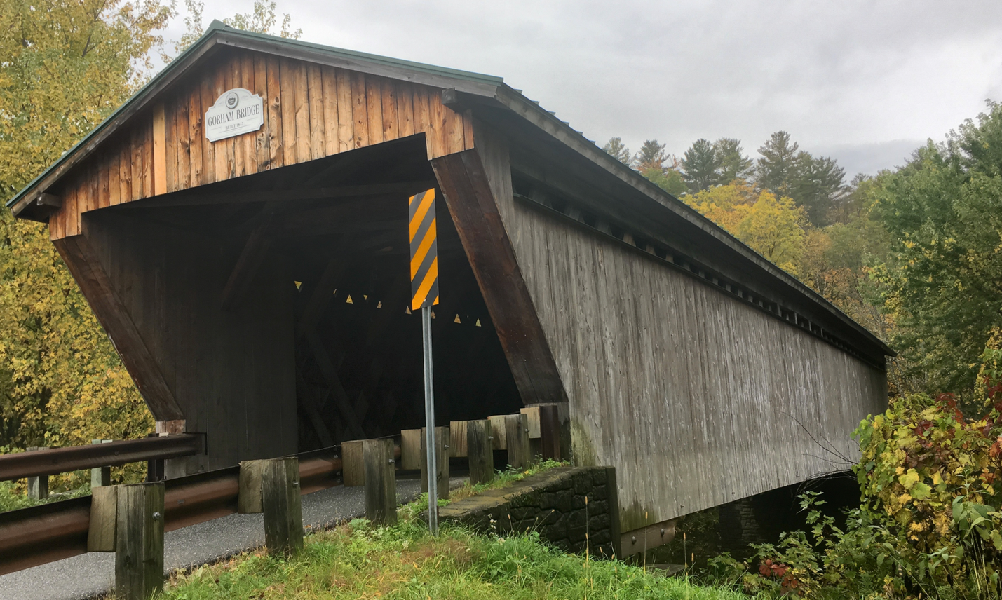
Oct 11, 2018
Hall /
Osgood Bridge
Sunderland Hill Road
Rockingham, VT, 05101Phone:
Location: Route 121 east 1.2 miles from junction with Westminster Street in Saxtons River, north on Sunderland Hill Road 200 feet to the bridge. The bridge is east of Saxtons River.
Hall Bridge, built about 1867, was destroyed by a truck in 1980, and an authentic replacement was built in 1982. Town lattice; 120 feet long.
Oct 7, 2018
Hammond Bridge
Off Route 7
Near
Florence, VT
Pittsford, VT, 05763Phone:
Location: W. off Route 7. Travel 2.2 miles of the junction of Route 3 at Pittsford Mills on Route 7 past Pittsford then left 0.8 mile and just right to the bridge.
The Hammond Bridge, built in 1843, carries Kendall Hill Road
over the Otter Creek, but it is closed to vehicular traffic. During the Flood
of 1927, the bridge floated more than a mile down Otter Creek. It was undamaged, and was towed back to his site on a barge of
empty barrels. Town lattice truss; 145 feet long. Parking in pulloff near bridge.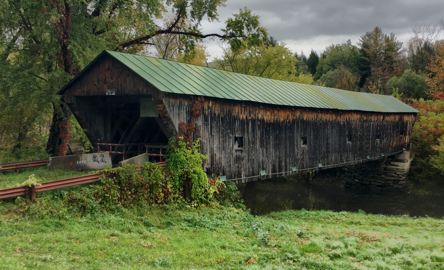
Oct 11, 2018
High Mowing Farm Covered Bridge
Windham County
Wilmington, VT
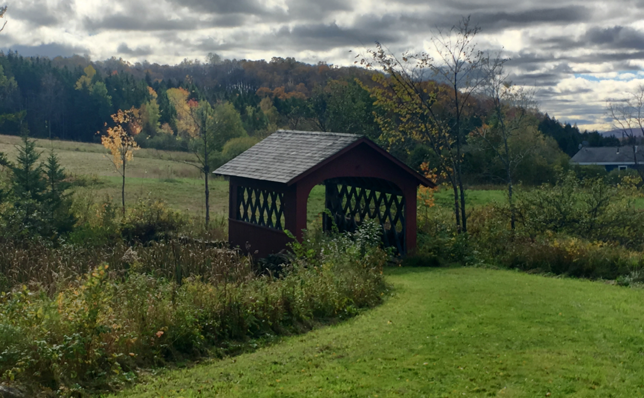
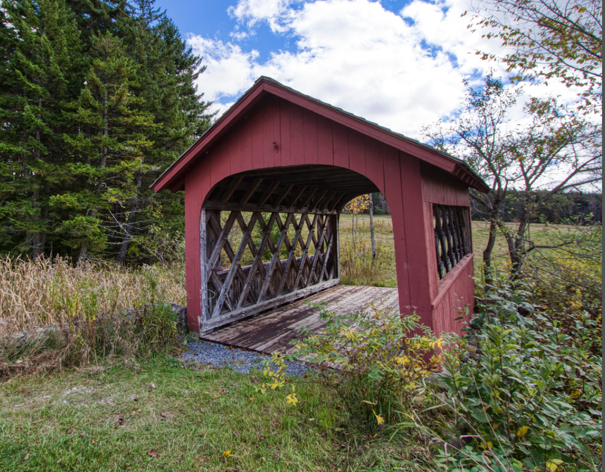
Oct 12, 2018
Martin’s Mill / Martinsville Bridge
Martinsville Road
Hartland, VT, 05048Phone:
Location: E. off Route 5. Travel 0.4 mile north of the junction I-91 on US5; then 0.6 miles right on Martinsville Road.
The Martins Mill or Martinsville Bridge, built in 1881,
carries Martinsville Road over the Lulls Brook. Town lattice truss; 135 feet
long. Parking to the right before crossing the bridge.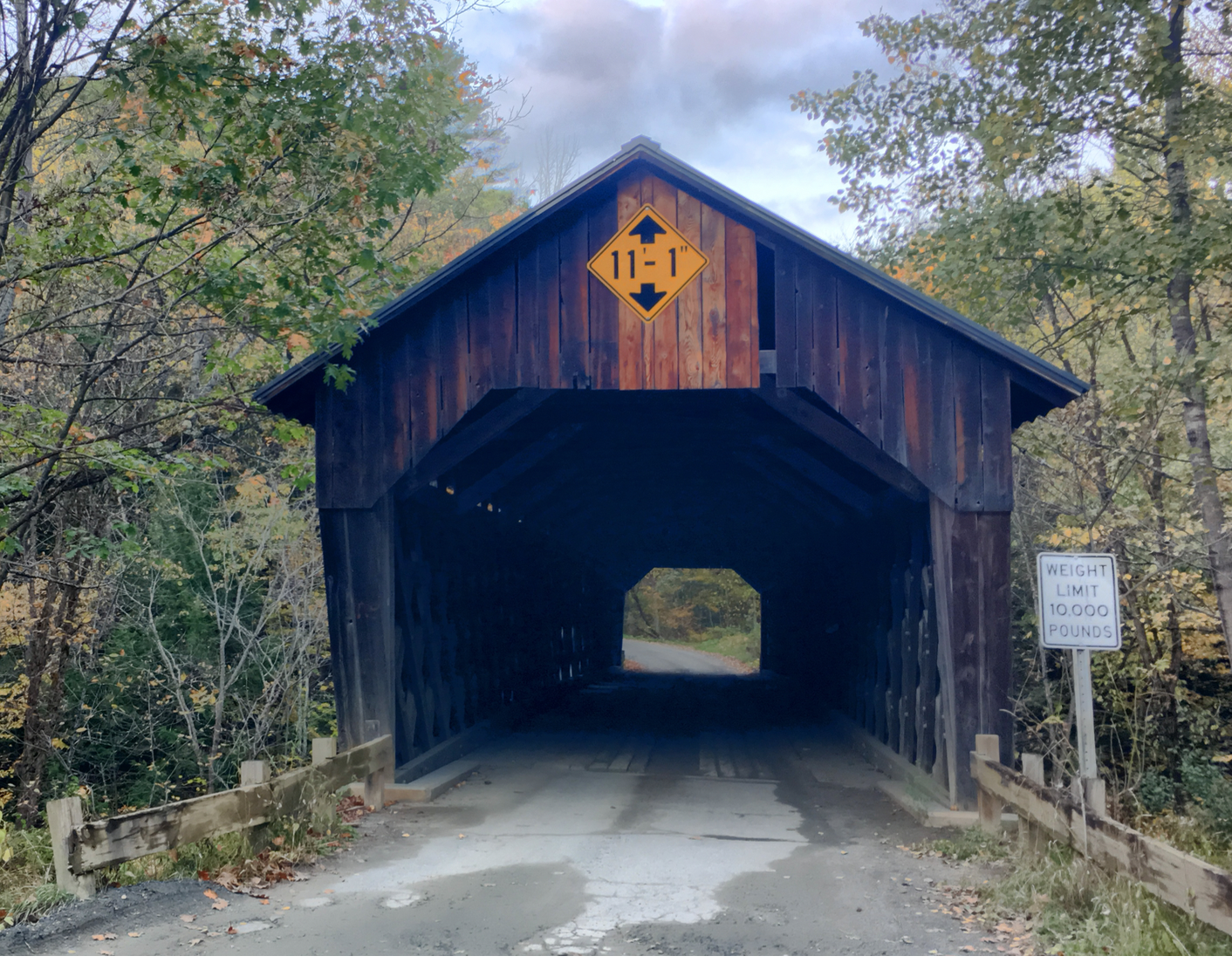
Oct 12, 2018
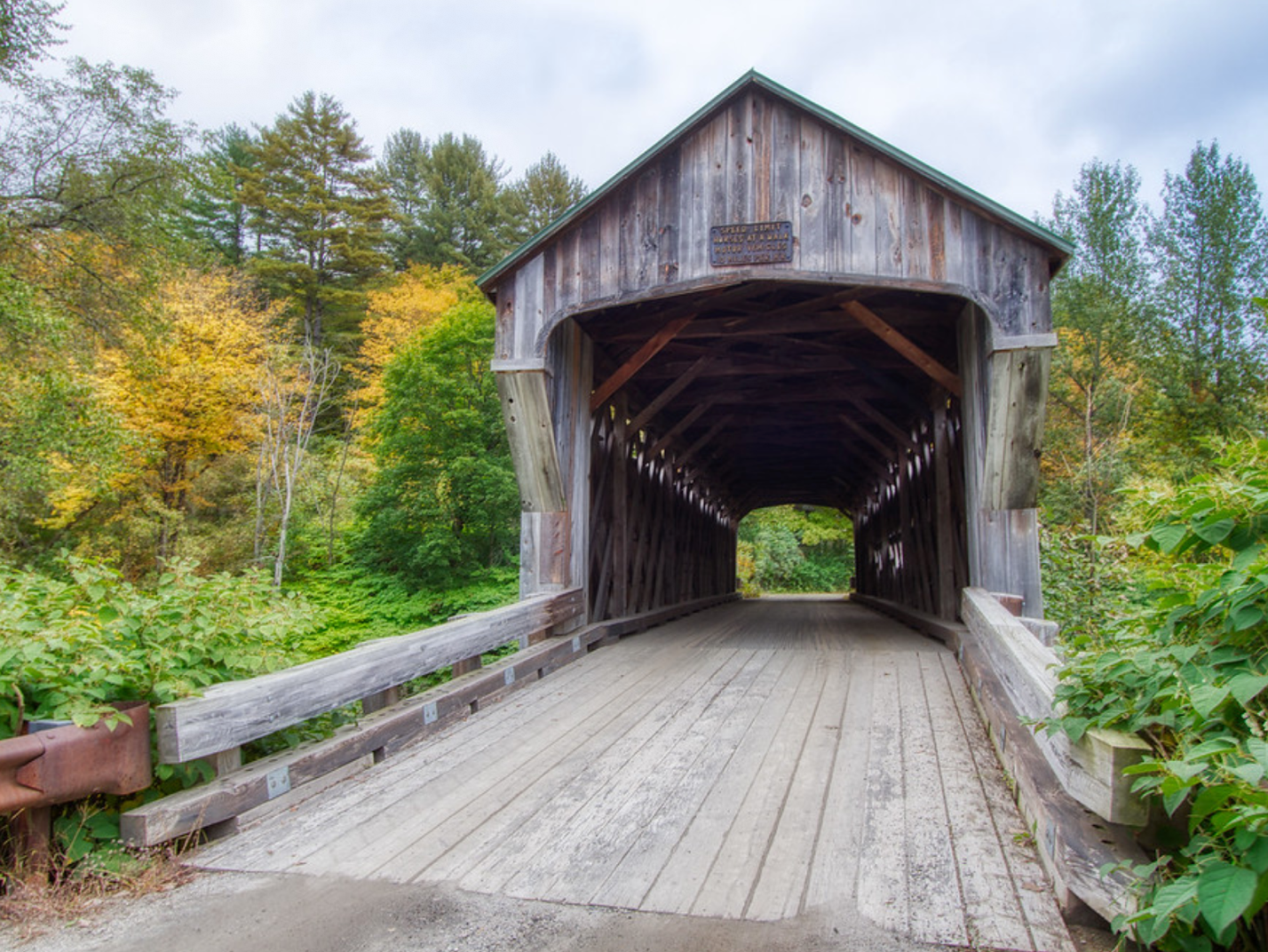
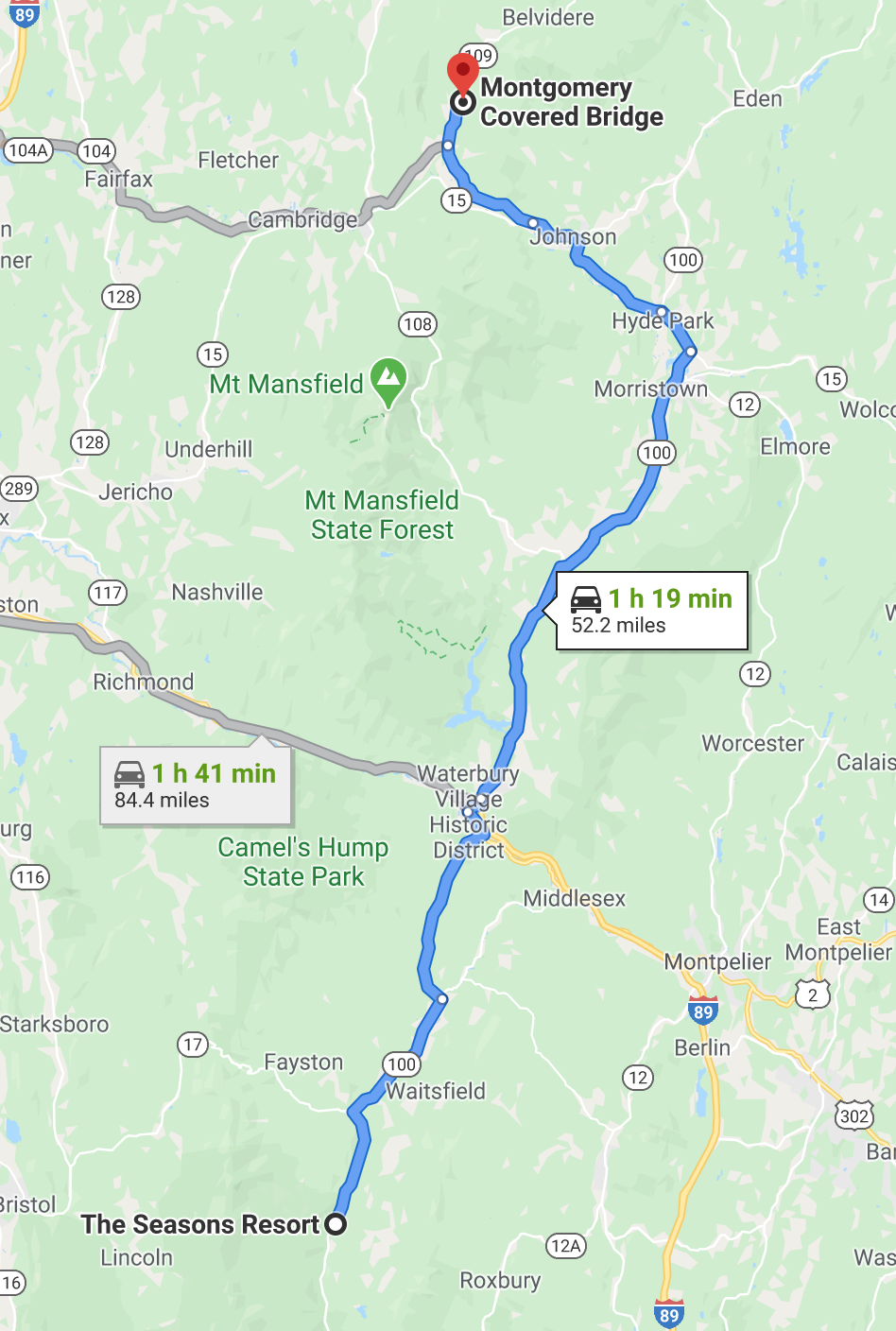
Montgomery Covered Bridge
also known as the Lower Covered Bridge is a wooden covered bridge that carries Montgomery Road across the North Branch of the Lamoille River in
Waterville, Vermont.
Also called Middle Covered Bridge since it is between the Jaynes Covered Bridge (also known as the Upper bridge) and the Village Covered Bridge (also known as the Lower bridge). All cross the same waterway.
Built in 1887, it is one of three covered bridges in the
town, and one of five on the river in a five-mile span. It was listed on
the National Register of Historic Places in 1974. 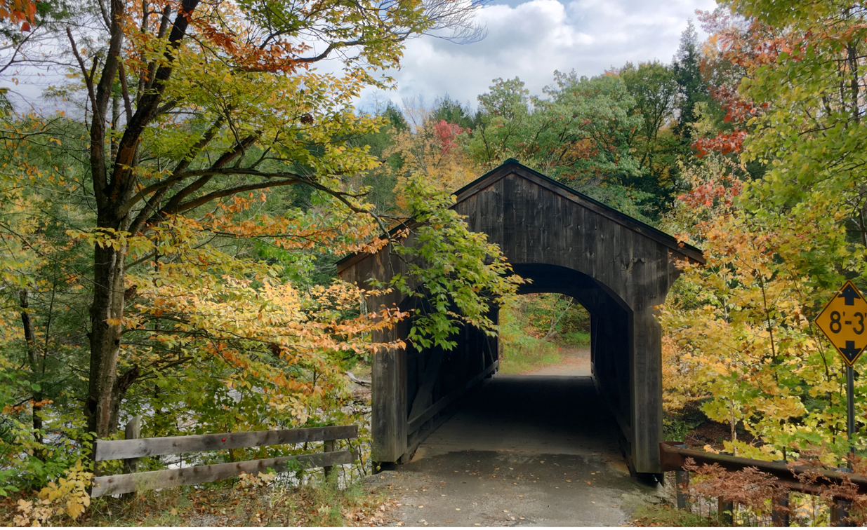
Oct. 9, 2018
Sanderson / Lower Bridge
Pearl Street Extension
Brandon, VT, 05733Phone:
Location: S. off Route 7 in Brandon off Pearl Street extension.
The Sanderson Bridge, built in 1838, carries Pearl Street
extension over the Otter Creek. Town lattice; 132 feet long. This bridge is no
longer open to traffic. A steel bridge directly next to the Sanderson Bridge
carries the traffic on Pearl Street. Parking in pull off near bridge.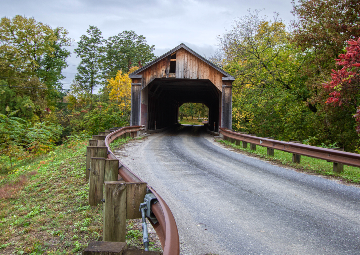
Oct 11, 2018
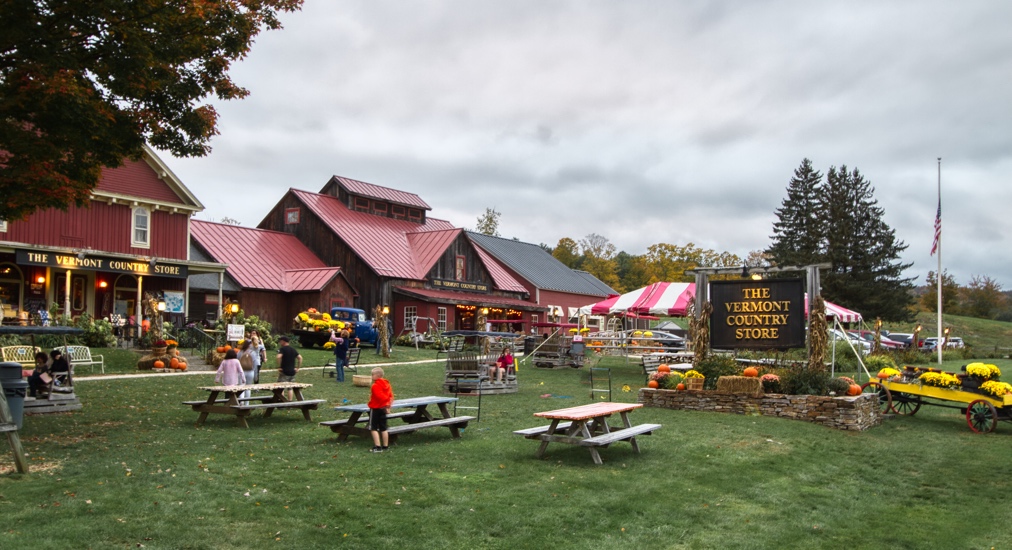
Vermont Country Store Kissing Bridge
Vermont Country Store
Rockingham VT
Kingpost through truss bridge over Rock Brook on Private drive
Built in 1967 from remains of the former Depot Bridge 45-13-12
Design - Covered Timber Kingpost Truss
Total length: 44.0 ft.
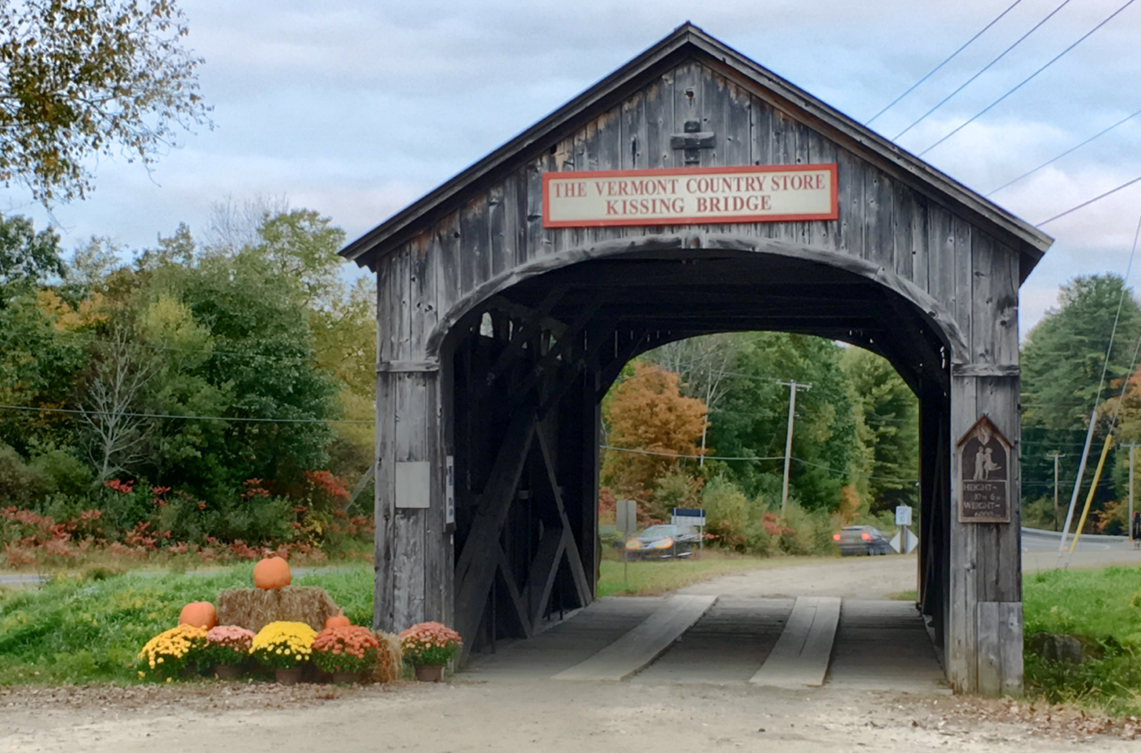
Oct 7, 2018 6pm
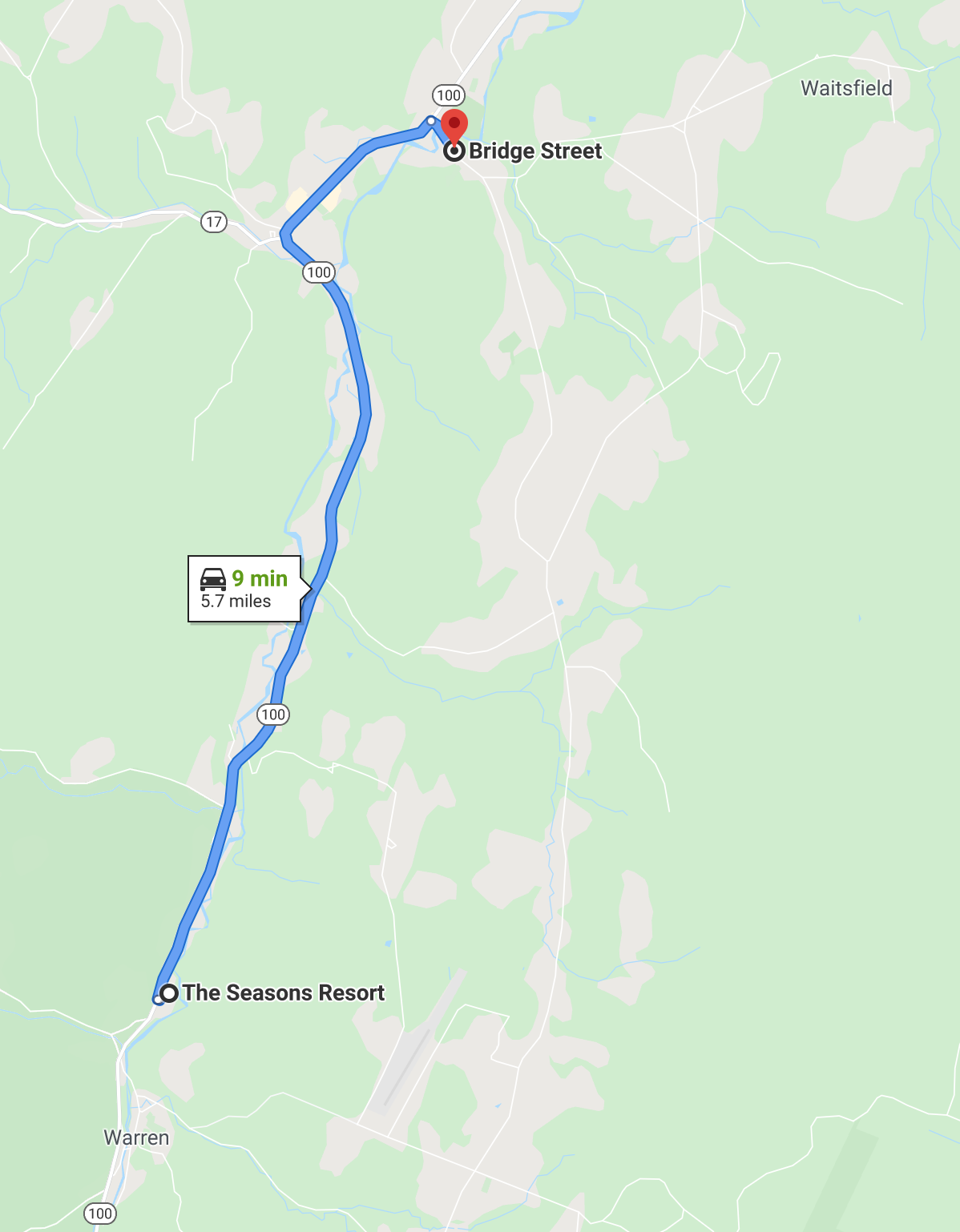
Village / Big Eddy Bridge
Bridge Street
Waitsfield, VT, 05673Phone:
Location: E. of Route 100 on Bridge Street.
This bridge, built in 1833 and restored in 1975, is the
oldest operating covered bridge in the state. It carries Bridge Street across
the Mad River. The basic structure of the Great Eddy remains intact, but much
of the flooring and braces were replaced in the 1970s. A pedestrian walkway, an
original component that had been removed, also was rebuilt in the 1970s. The
bridge has the longest clear span of any Burr truss bridge in Vermont.
Multi-kingpost and Burr arch; 105 feet long. Parking available on village
streets with a short walk to the bridge.
Oct 13, 2018 10:47am
Warren Bridge
Warren Village Road
Warren, VT, 05674Phone:
Location: E. of Route 100 on Warren Village Road.
The Warren Bridge, a prominent symbol of the Town of Warren,
was built in 1880, and it carries Warren Village Road over the Mad River in
Warren. Unique features of this structure are the different portal openings at
either end of the bridge. Queenpost truss; 59 feet
long. Parking available along Covered Bridge Road.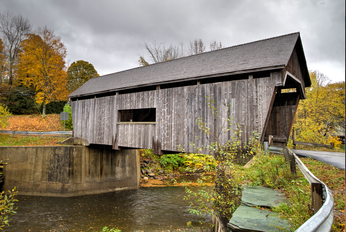
Oct 11, 2018
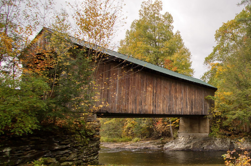
Worrall Bridge
Williams Road
Bartonsville, Town of Rockingham, VT, 05143
Location: From Lower Bartonsville Road go south 0.5 miles from Bartonsville; continue south on Route 103 0.4 miles; east on Williams Road; then 0.2 mile to the bridge.
The Worrall Bridge, built in 1868 by the Sanford Granger, carries Williams Road over the Williams River. Town lattice; 86 feet long. Parking on west side of bridge.
The Worrall Covered Bridge, also known as the Woralls Bridge is a wooden covered bridge carrying Williams Road across the Williams River in Rockingham, Vermont, United States. Built about 1870, it is the only surviving 19th-century covered bridge in the town, after the Hall Covered Bridge collapsed in 1980 and was replaced in 1982, and the Bartonsville Covered Bridge was washed away by Hurricane Irene in 2011 and replaced in 2012-2013. The bridge was listed on the National Register of Historic Places in 1973.[1]
Oct 7, 2018
Map of all Vermont Bridges
Bridges - Oct 7, 2018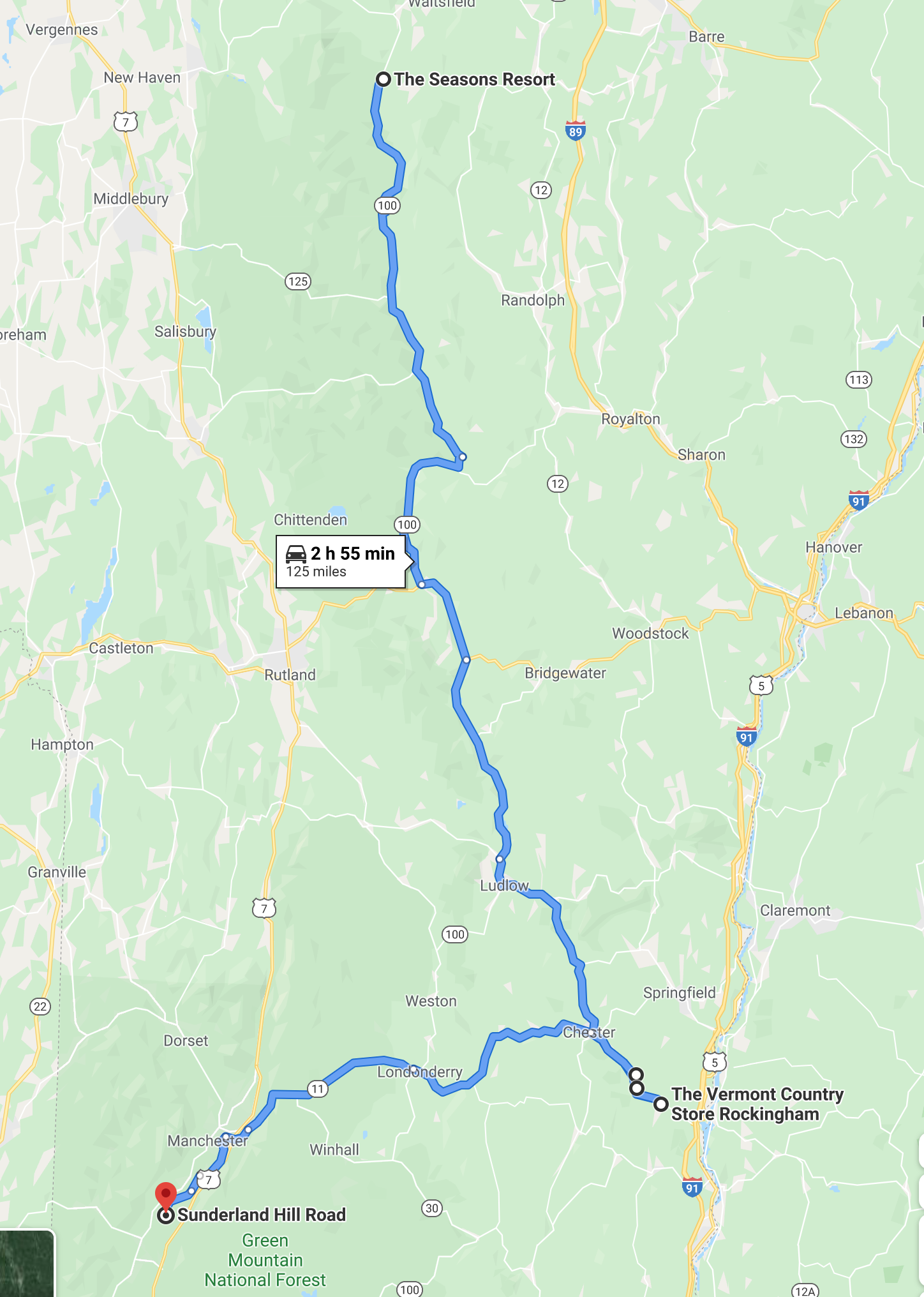
Bridges Oct 9, 2018
Bridges Oct 11, 2018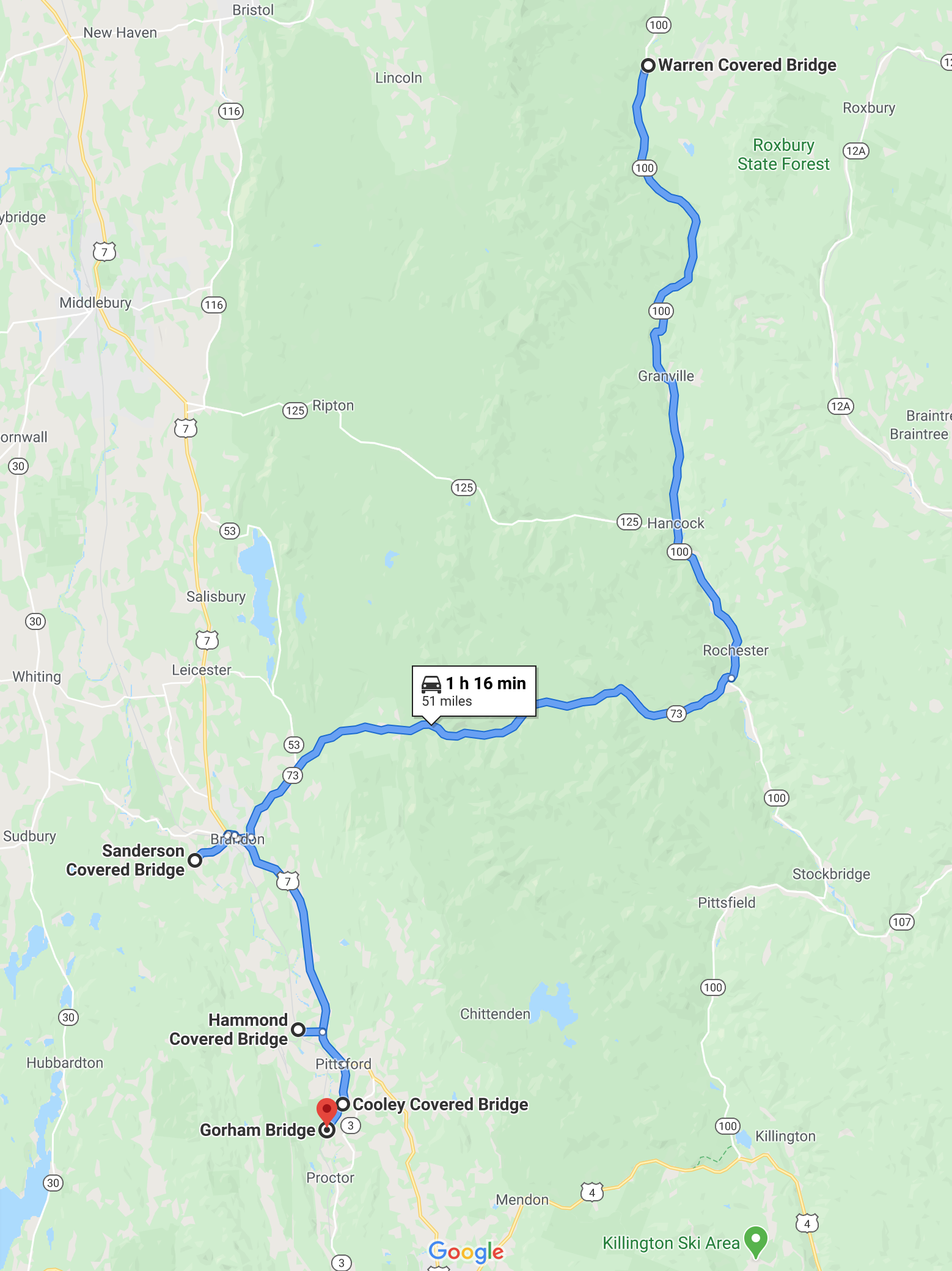
Bridges Oct 12, 2018
Bridges Oct 13, 2018